This year Los Angeles County Metro Rail celebrated its 25th anniversary. Despite having constructed six rail lines and two bus rapid transit lines during this quarter century, public transit retains a mode share of just 10.8 percent of the city of Los Angeles’ commuting population (as of 2013) and traffic gridlock is a constant feature roadways throughout the region. Understandably, transit ridership follows no simple formula. The degree of patronage of a particular transit line depends on a host of environmental factors including surrounding residential and job density1, the level of roadway congestion and parking availability2. Operational aspects such as line frequency and upkeep of vehicles and waiting areas3 also influence line ridership, although these factors depend more on system management rather than the qualities of a particular line. Even strong patronage of a transit line, may not necessarily draw cars off the road, if more take their place. Nevertheless, of all the hypothetical rail and bus rapid transit routes (or line extensions) that Metro has not yet greenlighted (at least in the short term), the following offer the greatest potential in terms of ridership and environmental impact. Metro should, accordingly, incorporate these routes into its expansion efforts in the years to come.
An Integrated Sepulveda Pass rail project could ease traffic and improve mobility on one of the nation’s most congested corridors.
The stretch of the 405 between Westwood and Sherman Oaks is one of the most congested freeway corridors in the country and for a good reason. To the west of the freeway, the rugged terrain of the Santa Monica Mountains National Recreational Area impedes roadway development, resulting in no transmontane thoroughfare for over six miles (see measurement). To the east, narrow canyons provide for several roadways of limited width and capacity up until the Cahuenga Pass, eight miles distant. As such, the Sepulveda Pass freeway serves as a chokepoint, funneling almost all traffic between the coastal regions of the Los Angeles basin (containing significant job and entertainment clusters, as well as the airport) and the entire San Fernando Valley (with a residential population of almost two million people and major employment centers in Warner Center, the Sherman Oaks-Encino area and along the old Southern Pacific Railroad line in Van Nuys), as well as regions further north and east (like the Antelope Valley and Pasadena). By forcing single-occupant vehicles into situations of congestion, chokepoints provide one of the best advantages over the automobile for grade separated mass transit vehicles3. Extending to LAX in the South and the Sylmar Metrolink (and future High Speed Rail station) station in the north (see metro’s map), it is easy to see a transit line that passes through or tunnels near the Sepulveda Pass, becoming one of the most profitable in the system. Such a line can either take the form of heavy rail or light-rail, possibly combined with bus rapid transit (or in my preference, commuter rail).
“Pink” Line/Crenshaw Line Extension
A new urbanist’s paradise, dense, walkable West Hollywood would get light-rail connections to the airport, Wilshire Corridor and Hollywood with a Crenshaw Line Extension.
Hollywood is in many ways the epitome of Los Angeles, and for good reason. It is not only the place where the tourists flock to photograph “stars” (or crazy street musicians), but serves as the region’s high-energy nightlife hub. As such, Hollywood deserves a link to LAX. Extending the Crenshaw Line (currently under construction) from its designated terminus at the Expo/Crenshaw station up to the Red Line would not only accomplish this but integrate West Hollywood (’s) main artery along Santa Monica Blvd., which boasts California’s most walkable commercial district and the LA area’s most prominent LGBT nightlife area, into the Metro rail network. By connecting with the extended Purple Line at either La Brea, Fairfax, or San Vicente (see the map on page 2-5 of this 2009 report), moreover, the northward extension would also feed off airport-bound (or night-life bound) travelers from a wide stretch of the central Wilshire corridor. Unfortunately, this project is not even listed in Metro’s Long-range Transportation Plan (see pg. 21 of the plan), so supporters of this project will need to up their lobby game.
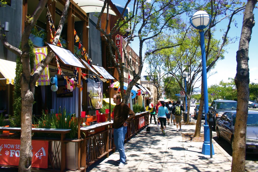
According to renowned transit consultant, Jarrett Walker, the best-performing transit lines tend to service linear corridors, where activity and employment hubs are distributed evenly along an arterial4. The roughly 2-mile stretch of Beverly Boulevard from Robertson to La Brea fits this concept, as the street weaves together The Grove/Farmers Market shopping complex, CBS studios, the Fairfax retail district, the Beverly Center Mall, Cedars-Sinai Hospital and West Hollywood Design district (the West Third Restaurant District and the famed Melrose Avenue retail corridor lie within a half-mile of the street). To the east, Beverly offers connections to Koreatown, Downtown and Union Station and to the west, to Beverly Hills and Westwood (should the Rapid Line turn down Santa Monica and Beverly Drive, like the current 14 bus, so that it intersects with the Wilshire Rapid and subway). To the north and south, moreover, the nearest rapid bus lines (the Santa Monica and Wilshire rapids, respectively), are a good mile away, about twice the maximum distance the average person will walk to a frequent bus line. Best of all, no freeway even comes close to this stretch of Beverly (thanks to 1960s-era freeway revolts, there are none within roughly 2.5 miles), while neither Beverly nor its parallel arterial streets (Melrose and Third) are particularly wide. Not surprisingly, Beverly, along with its parallel arterials and side streets, fills up with traffic on both weekdays and weekends. Reserving the outermost lane of Beverly Boulevard for bus travel (with restored Rapid Service), rather than parking would disincentivize further growth in traffic volume while offering an alternative to persisting congestion. Despite current lackluster bus ridership levels along Beverly’s western stretch, the pedestrian-friendly design of many of the storefronts in this area, which front the sidewalk directly, gives a bus rapid transit system with dedicated lanes and well-kept waiting areas all the more potential to mitigate traffic.
Green Line Extension to Norwalk
One of the most frustrating defects in the current Metro Rail system is the 2.5 mile gap between the eastern terminus of the Green Line and the Orange County Line Metrolink station. This small gap stunts an important connectivity between Orange County’s tourist and commercial destinations and LAX (thereby helping create nasty traffic jams along the stretch of I-605 between I-105 and I-5) and also puts Norwalk’s significant complex of government offices (including the Los Angeles County Clerk’s Office) just beyond the light rail’s reach. Should the Sepulveda Pass project to LAX be completed, an extended Green Line would also offer one stop access-via a transfer at the 96th street station-from Orange and Riverside Counties to the entire Westside. As some point out, the Orange County Line’s current low frequencies (a product of heavy freight use on the tracks) threaten the viability of connection to an all-day light rail service: However, Metrolink can potentially relieve this problem through adding more tracks on the line (as has indeed been proposed by the LOSSAN rail authority, see pg. 34) and should (given the heavy two-way commute volumes). Though it might require tunneling, completing this project, if done right, could significantly boost the Green Line’s long-struggling ridership levels (which are less than that of the phase 1 segment of the Expo Line) and might shift some traffic off the neighboring freeways: a win in the long-term for both Metro and the environment.
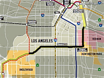
The Harbor Subdivision rail corridor runs from Union Station to Inglewood. The black shading indicates the route of metro’s planned Active Transportation Corridor parallel to the tracks.
Harbor Subdivision
Running from Downtown Los Angeles to El Segundo along Slauson Avenue, the Atchison, Topeka and Santa Fe’s abandoned Harbor Subdivision offers a prime route for heavy or light rail (especially with the construction of an adjacent active transportation corridor). A transit line along this abandoned railway would provide a one-seat ride from LAX to Downtown Los Angeles’ Union Station transit hub while creating a east-west transit artery through the heart of South Los Angeles, which has among the largest concentrations of transit-dependent and carless residents in Los Angeles County (but is only served by rail transit on the fringes). This line would not only connect South Los Angeles’ residents to three of Los Angeles’ largest jobs centers (the white collar-cores in Downtown LA and El Segundo and the blue collar, industrial core along the LA river in Vernon) but offer one-stop access to regional destinations through Union Station. A highly feasible (based on the track alignments near Slauson station) eastward branch off to Huntington Park, Maywood and Bell would bring one of LA County’s busiest shopping districts and most densely-populated residential areas within reach of both the airport and Westside. Metro has seriously explored this line in the past but has put it on the backburner since approving the Crenshaw Line. With Los Angeles Mayor Eric Garcetti seeking to host thousands of Olympic athletes along the LA River in 2024, this line may get the opportunity for promotion.
Ventura Boulevard Bus Rapid Transit
The lower San Fernando Valley’s primary commercial artery, Ventura Blvd boasts a long stretch of medium-scale dining and retail business, punctuated by several clusters of large-scale office buildings (for instance, near the junctions with Laurel Canyon Blvd in Studio City or Sepulveda Boulevard in Sherman Oaks). Although the hillside neighborhoods to the south are characterized by sprawling McMansions, the north side of the arterial is flanked by medium-density neighborhoods comprised of duplexes and small apartment buildings at least as far as the 405. As the Valley’s southernmost east-west arterial, moreover, Ventura Blvd currently “funnels” bus routes that come down north-south arterials like Reseda, Van Nuys and Woodman, carrying these to transfer points (see map) for overhill travel. Should the Sepulveda Pass Line become reality, this “funnel” function will acquire increased importance as a means of dispersing passengers from the Sepulveda Pass Line across the valley (see Letsgola's map for an example of how this might work). Due to the need to operate multiple routes along this arterial, a bus rapid transit lane from Universal City City Station to Woodland Hills makes the most sense here. Because Ventura Blvd has so many damn automobile lanes already, a dedicated bus lane here will, hopefully, avoid the wrath aroused by the Wilshire Bus Lane. (hopefully…)
- Jarret Walker’s Human Transit provides a good, simple explanation for the layman of why (built) density matters for transit.
2. See Chatman, 2008, who suggests that “Network Load Density”, i.e. the number of roadway users per unit of roadway capacity, has a negetive effect on automobile use and a positive impact on alternative forms of travel like transit. http://ced.berkeley.edu/downloads/pubs/faculty/chatman_2008_deconstructing-development-density.pdf
3. Walker. Human Transit. Page 51.
4. Walker. Human Transit. Page 205.
5. Walker. Human Transit. Page 169.
There should be a light rail line between the Norwalk Stn and the Sierra Madre Villa Stn, to take traffic off of the 605. Maybe up Rosemead Blvd.
ReplyDelete